Critical Minerals

What are critical minerals?
Critical minerals are non-fuel minerals and elements that are vital to electronics and other advanced technologies. These minerals are often obtained from overseas sources, including China and India, and are at high risk should supply lines be disrupted, as they were during the COVID-19 pandemic. As of 2022, more than 50 minerals have been designated as critical.
The Department of the Interior has designated 31 elements as critical minerals: Lithium, beryllium, magnesium, aluminum, titanium, vanadium, chromium, manganese, cobalt, nickel, zinc, gallium, germanium, arsenic, rubidium, zirconium, niobium, ruthenium, palladium, indium, tin, antimony, tellurium, cesium, hafnium, tantalum, tungsten, iridium, platinum, and bismuth.
Several of the elements have been designated critical materials for clean energy supply chains by the Department of Energy: Lithium, fluorine, magnesium, aluminum, silicon, cobalt, nickel, copper, gallium, iridium, platinum, praseodymium, neodymium, terbium, and dysprosium.
In addition to these critical minerals, there are many rare earth elements.
Light rare earth elements: Lanthanoids, lanthanum, cerium, praseodymium, neodymium, samarium, and europium.
Heavy rare earth elements: Scandium, yttrium, gadolinium, terbium, dysprosium, holmium, erbium, thulium, ytterbium, and lutetium.

Critical Minerals Research in Kansas
The KGS and its partners (the state geological surveys of Iowa, Oklahoma, Missouri, Nebraska, Illinois, Ohio, Kentucky, and Indiana, and the Osage Nation Minerals Council) are studying the potential of recovering critical minerals from within the region.
Current critical mineral research focuses on three goals:
- Explore the potential of Kansas rocks—coal deposits, black shales, salt, and others—to be developed as sources of critical minerals.
- Study the feasibility of recovering critical minerals from mining waste piles and tailings, brine (a byproduct of oil and gas production), and similar waste associated with coal-fired power plants and industrial recyclers.
- Support critical mineral research and its potential to spark new mining activity and to provide funding to remediate legacy mining wastes.
DOE CoreCM Phase 1
The Carbon Ore, Rare Earth, and Critical Minerals (CORE-CM) initiative of the U.S. Department of Energy addresses critical mineral supply chain research and downstream manufacturing. The KGS has participated in Phase 1 and Phase 2 of this research program.
Image: Lyon County KGS core scanner results showing critical mineral concentrations from the scanner portable XRF unit. Wireline curves are from the Weatherford GSI pulsed neutron geochemical instrument.

USGS Earth MRI
Earth MRI is a collaboration between the USGS and state geological surveys. The goal of Earth MRI is to improve our knowledge of the geologic framework in the United States and to identify areas that may have the potential to contain undiscovered critical mineral resources. Enhancement of our domestic mineral supply will decrease the nation’s reliance on foreign sources of minerals that are fundamental to our security and economy.
Earth MRI Black Shales
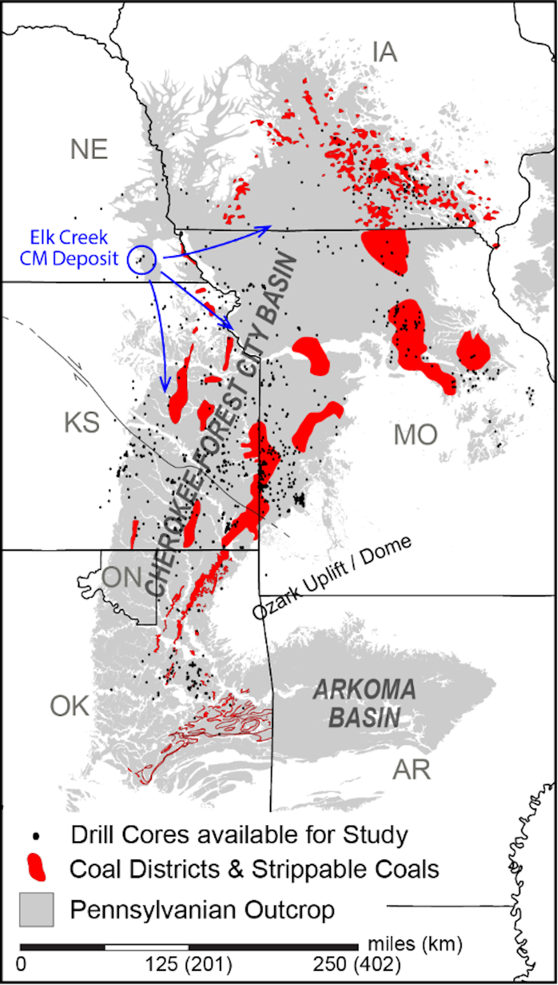
The Kansas Geological Survey leads a $975,000 project in collaboration with state geological surveys from Kansas (Forest City-Cherokee Basins), Missouri, Iowa (Forest City Basin), Illinois, Indiana (Illinois Basin), Ohio, and Kentucky (Appalachian Basin). This initiative explores Pennsylvanian-aged black shales in the U.S. Midcontinent as a potential source of critical minerals, including rare earth elements. Running from January 2023 to January 2026, the project focuses on systematic sampling, geochemical analysis, and cross-basin stratigraphic correlations to assess these mineral resources and reduce reliance on foreign sources.

Earth MRI Evaporites
This study will provide an integrated geochemical and stratigraphic evaluation of Permian bedded evaporites in Kansas focused on identifying and mapping zones of critical mineral enrichment.
Image: Map showing outcrop belts of Permian salt-bearing units along with the subsurface footprint of marine evaporites throughout central and western Kansas. Multiple overlapping thick salt units underly approximately two-thirds of the state.

Elk Creek Earth MRI Regional Geophysical Survey
Strongly magnetized rocks of the Elk Creek carbonatite and surrounding features will be imaged by the proposed survey.

Ozark Plateau Earth MRI Airborne Magnetic and Radiometric Survey
Surface and subsurface mapping of Mississippi Valley-type (MVT) will be imaged in parts of Kansas, Missouri, and Arkansas.

News and Recent Activity

Critical Materials Crossroads team advances as finalist for NSF award of up to $160M over a decade

KGS Assesses Potential for Critical Minerals in Eastern Kansas

Kansas Geological Survey Receives Grant to Study Critical Minerals Mining Potential in Region
Kansas Geological Survey Gets Funding for Preservation and to Study Critical Minerals
LAWRENCE — Hundreds of thousands of drilling records and rock cuttings, historical aerial photographs, and other resources housed at the Kansas Geological Survey provide valuable insight into the state's natural resources. To continue long-term efforts to preserve its collections, the KGS will receive increased annual funding from the U.S. Geological...