Airborne Electromagnetic Survey of Aquifer Conditions in Northwestern Kansas
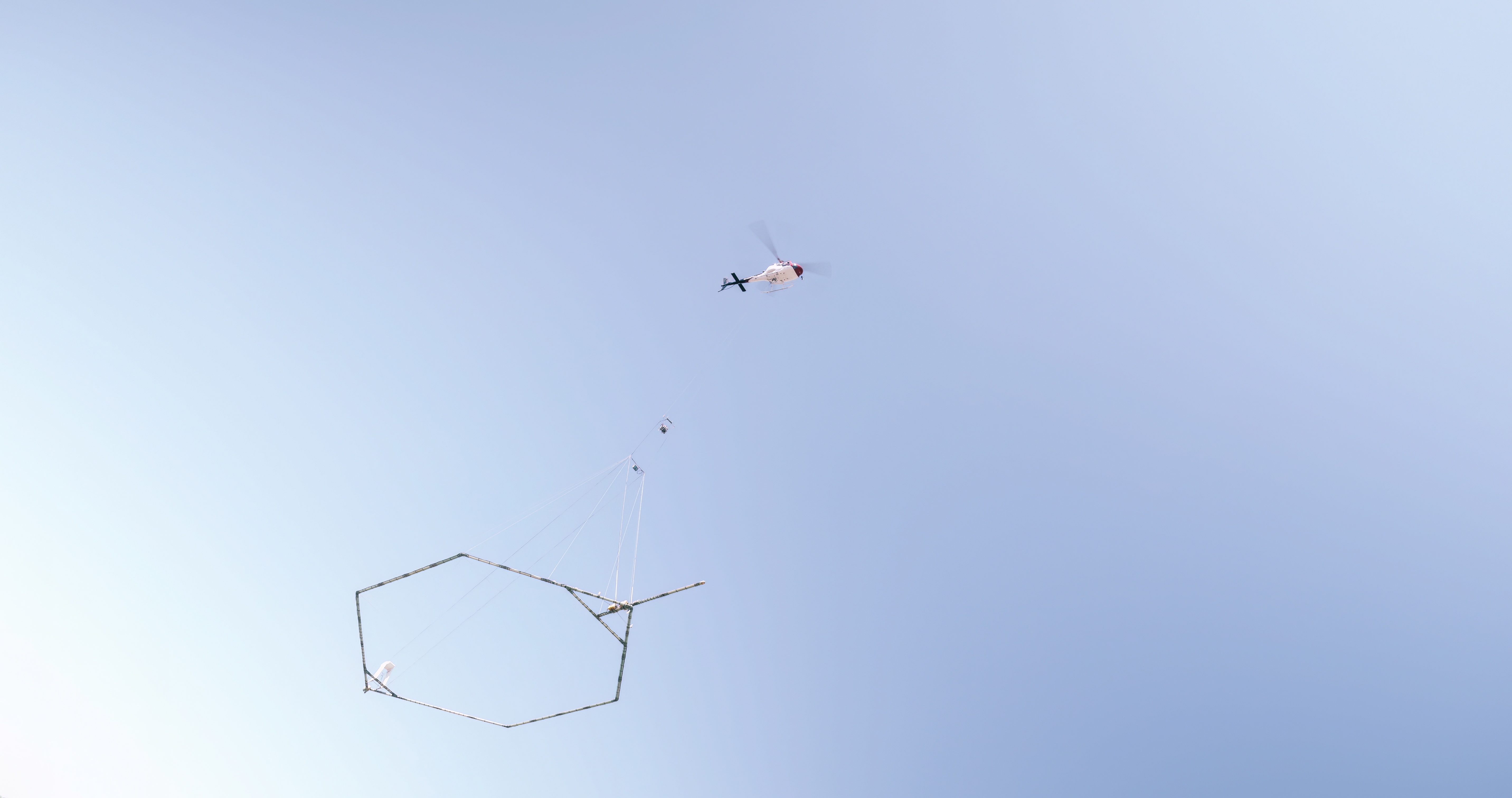
Beginning in late May and continuing for much of June, residents of northwest Kansas may see a low-flying helicopter towing a large hexagonal frame. This unusual arrangement is part of a project to map groundwater conditions in the Ogallala aquifer in Northwest Kansas Groundwater Management District No. 4.
Thanks to funding from the Governor’s Office and the Kansas Water Office, GMD4 and the Kansas Geological Survey, working with Aqua Geo Frameworks, LLC of Fort Laramie, WY, have planned the helicopter flights to develop a better understanding of the Ogallala aquifer. AGF has performed more than 20,000 miles of similar airborne electromagnetic surveys in Nebraska, Colorado, and Wyoming, but this will be the first of its kind flown in Kansas.
Scientific equipment will hang below the helicopter 100 to 200 feet above ground. The equipment is designed to map geologic structures and groundwater resources to depths of approximately 1,000 feet below land surface. The helicopter will be flown at about 50 mph by pilots who are specially trained for low-level flying and have a great deal of experience with airborne electromagnetic surveys. Flights will not occur over residential areas and other buildings, livestock feeding operations, or wind turbines.
The Ogallala aquifer is the major water resource for agricultural, industrial, and municipal use in GMD4. Intensive pumping of the aquifer over the last 60+ years has resulted in large groundwater level declines in Sherman, Thomas, Sheridan, and Cheyenne counties. The information obtained in these flights will allow GMD4 and the Kansas Geological Survey to better assess the nature and continuity of water-yielding materials in the aquifer. The ultimate objective of the project is to obtain information that will assist GMD4 in developing strategies for charting more sustainable paths for the Ogallala aquifer in the district.
For further information about the planned survey, contact Shannon Kenyon, GMD4 manager (skenyon@gmd4.org, 785-462-3915), Jim Butler of the Kansas Geological Survey (jbutler@ku.edu, 785-864-2116), or Jared Abraham of Aqua Geo Frameworks (jabraham@aquageoframeworks.com, 303-905-6240). A video describing previous airborne electromagnetic surveys in Nebraska is available on the GMD4 website (gmd4.org).
The Kansas Geological Survey is a non-regulatory research and service division of the University of Kansas. KGS scientists study and provide information about the state’s geologic resources and hazards, including groundwater, oil and natural gas, rocks and minerals, and earthquakes.
(Photo courtesy of Aqua Geo Frameworks, LLC)