Water-Level Measurement Project FAQs
Water-Level Measurements Projet FAQs
To measure the wells, team members rub blue chalk on the end of a steel tape, attach a lead weight to pull the tape down, and lower the tape into the well. When they remove the tape from the well, the chalk helps easily distinguish wet from dry. The depth from the surface to the top of the water is calculated by subtracting the length of the wet part of the tape from the amount of tape lowered into the well hole.
A representative sampling of wells is made, so that the resulting measurements provide an accurate but cost-effective snapshot of water levels in the aquifer. Wells included in the annual water-level census are selected based on the following characteristics:
- what aquifer they penetrate
- the presence of substantial amounts of water in the aquifer
- where the wells are located
- how they were constructed
- the amount of historical data available
- how the wells are used
In general, one well in every 16-square-mile area is measured.
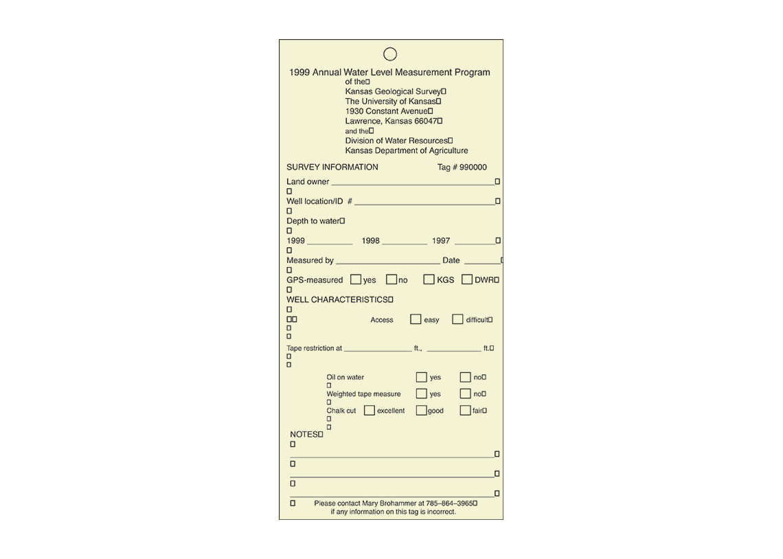
Once a well has been sucessfully measured, a weather-resistant tag is attached to the well so landowners can tell, from a distance, that their well has been measured. Different colored tags are used each year. The tags provide information about well location, landowner's name, measuring agency, measurement access, obstructions, the quality of the water line, oil on water, remarks, depth to water in the current year, depth to water in the two previous years, date, and measurer identification. Tags are for the convenience and information of owners or operators, who can remove the tags if they so choose.
For the water-level data to be useful, it is critical that the same well be sampled each year using identical methods. Map-reading errors, incorrect legal descriptions, and confusion with nearby wells can lead to misidentification. To eliminate such errors, KGS researchers use a computer system called Water Witch, which uses global positioning system (GPS) technology and an extensive digital map system to accurately locate wells in relation to such geographic landmarks as towns, highways, roads, houses, and rivers and streams. Besides acting as a navigational aid and data recorder, Water Witch combines detailed site comments and photographs to enhance and improve location certainty, well familiarity, and visual identification.
Quality-control procedures are an important part of the water-level measurement program. Wells with measurements that deviated from the local trends during the initial visit are revisited and remeasured to confirm the recorded water depths. Wells that were not successfully measured during the primary trip also are revisited. In addition, about 6% of the wells measured by the KGS are randomly selected for remeasurement to make sure they were accurately measured during the initial trip that year.
Once data from the annual water-level measurement program are recorded and checked, they are entered into a large, statewide computer database known as Water Information Storage and Retrieval Database (WIZARD) and are electronically available to the public. The KGS archives and maintains WIZARD. Various kinds of scientific analyses that follow the yearly data acquisition —including determinations of saturated thickness, depth to water, depletion trends, and water-resource predictions — are all possible using software that can directly access WIZARD.
WIZARD users can obtain information for Kansas groundwater resources for areas as small as a section or as large as the entire state. Data analysis, reports, and general queries also are available for the more than 50,000 wells that make up WIZARD's primary inventory.
Data gathered from well measurements are used for a variety of purposes, both public and private. Organizations and governmental agencies use the data, especially in mapped form, to develop an understanding of trends in regional water levels. That understanding is then used in making decisions about water and in taking regulatory actions. Groundwater management districts use the results to better understand water levels in their area. The Division of Water Resources of the Kansas Department of Agriculture uses the data in making decisions about applications for new water rights and in declaring and regulating intensive groundwater use control areas, where new groundwater pumping is extremely limited. Private institutions use the measurements to appraise the value of land and in making lending decisions. Private landowners use the data to monitor water levels in their own wells and in those nearby. All of these uses depend on high-quality data about water levels.