Skip to main content
The University
of
Kansas
MENU
link to menu page
THE UNIVERSITY
of
KANSAS
Advancing Science, Serving Kansas
Kansas Geological Survey
myKU
Email
Canvas
Enroll & Pay
Jayhawk GPS
Close
Search this unit
Start search
Submit Search
Main navigation
Home
Research Programs
Select to follow link
Water Resources and Geohydrology
Select to follow link
AWQUA: Aquifer Water Quality Assessment for Kansas
Select to follow link
Sampling your own well
Kansans Live Well Program
K-12 Teacher Training Opportunities
AWQUA Team
AWQUA Publications
Water Quality Mapper (Beta)
KGS HydroLab
Energy
Select to follow link
Publications and Reports
Geophysics and Hazards
Geology and Mineral Resources
Geoarchaeology
Oil and Gas Data
Select to follow link
Oil and Gas Database
Oil and Gas Interactive Mapper
Drill Core Library
Kansas Geologic Sample Repository
Water Data
Select to follow link
WWC5 - Water Wells
WWC5 - Interactive Mapper
WIZARD - Water Well Levels
WIMAS - Water Rights
Master Well Inventory
Earthquakes
Publications
Select to follow link
Overview
Bulletins
Technical Series
Educational Series
Public Information Circulars
Research Spotlights
Open-File Reports
Midcontinent Geoscience
Outreach and Education
Select to follow link
Educational Resources
Select to follow link
Overview
GeoKansas
Teacher Resources
OGALLALA: The Groundwater Game
Paleocamp
Geologic Sites of Kansas
Geologic Time Scale of Kansas
Photo Library
Kansas Field Conference
Story Maps
Libraries and Archives
Select to follow link
Data Resources Library
Drill Core Library
Kansas Geologic Sample Repository
Historical Aerial Photos
Maps and GIS Data
Select to follow link
Cartographic Services
Maps
GIS Data
STATEMAP Summary (pdf)
Data Access & Support Center (DASC)
Coordinate Conversion Tools
People
Select to follow link
All
Administration
Cartographic Services
DASC
Energy
GIS and Computing Services
Water Resources and Geohydrology
Geology and Mineral Resources
Geophysics and Exploration Services
Kansas Geologic Sample Repository
ODYSSEY and Geoarchaeology
Public Outreach
Adjunct/Courtesy
Emeritus
In Memory
Organizational Charts
Contact
About the KGS
News
Positions Available
Info for
Prospective Students
Current Students
Alumni
Degree Programs
THE UNIVERSITY
of
KANSAS
University of Kansas logo
Advancing Science, Serving Kansas
Kansas Geological Survey
Menu
link to menu page
Search this unit
Start search
Submit Search
Home
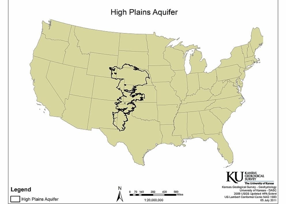
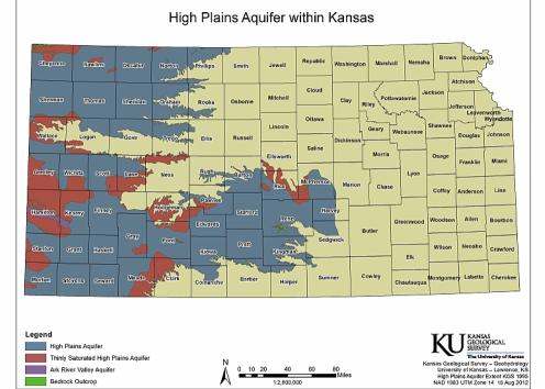
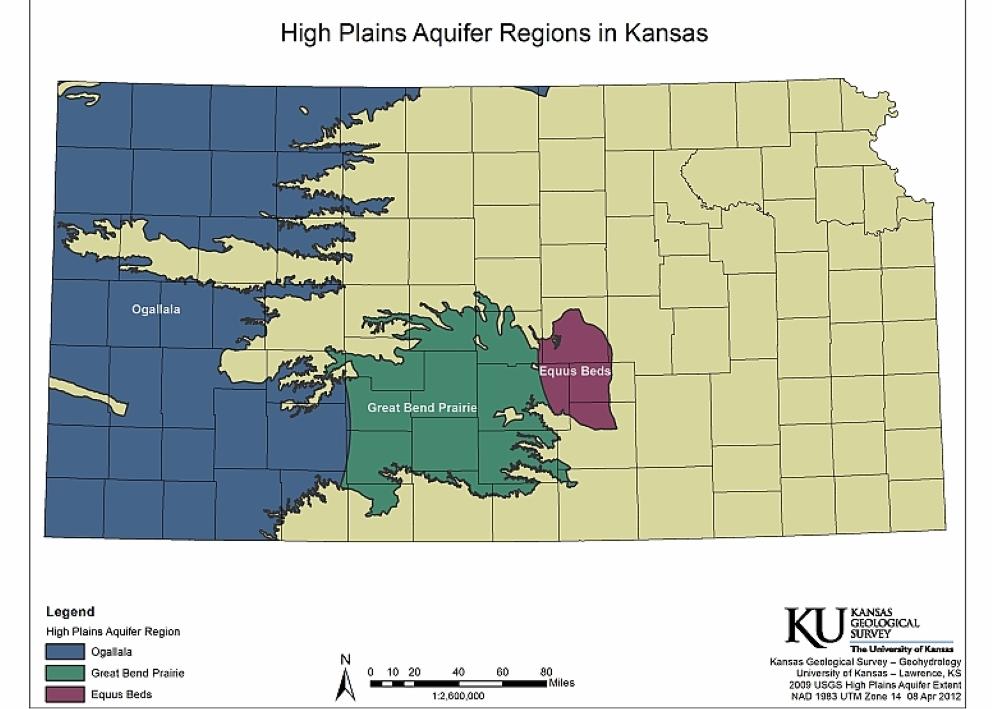
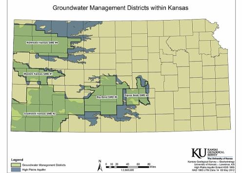
Aquifer Extent Maps
Close
Close
Close
Close